As the ship manoeuvred its way through the shipping in the bay, we passed a short, artificial channel. Chaundra had been reading David McCullough's The Path Between the Seas, a history of the several attempts to build the Panama Canal, and identified it as the remains of the French attempt to dig a canal through to sea level:
The history of the two French canal companies is (with hindsight) faintly comic, and Chaundra highly recommends the book.
The Panama Canal begins (or ends, depending on your direction of travel) on the Atlantic side with the Gatun Locks. Like all of the locks currently in operation the canal, it has two parallel flights. Chaundra and I both laughed at the enormous arrow-shaped signal indicating to oncoming vessels which of the flights they should enter, but admitted that it does make the intended direction clear.
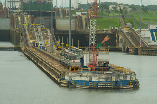
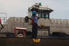
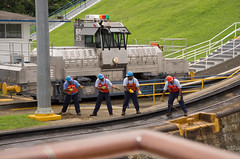
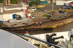
On either side of the pier, you can see sets of Locher rack rails and small unpainted locomotives. These are the so-called "electric mules" that guide ships through the canal. Four mules, two on each side, attended our ship through each of the locks, but some of the larger cargo vessels, with much less clearance on either side appeared to be guided by up to eight.
Right in front of the pier, you can see two rowboats. These are, contrary to all reasonable expectation, used in every passage through the Panama Canal to carry the tethering cables for the electric mules from the shore to the ship and back again. Yes, rowboats.
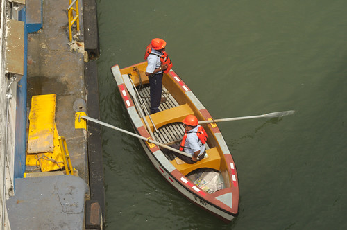
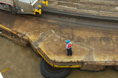
Watching the antics of these antiquated craft entertained us to no end while we waited for the locks to fill and empty. In fact, it was astonishing to see how much of the process was still manual; both of us had expected that many of these tasks would have been automated to speed up the passage, given that before the Great Recession, the Canal was operating fairly close to maximum capacity.
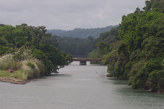
There are three stages to the Gatun Locks, going up from the Atlantic to the artificial Lake Gatun, formed by damming the Chagres River just 10 kilometres upstream of its outlet. From there, the canal route crosses Lake Gatun (passing by Barro Colorado Island, one of the more renowned neotropical research centers) and across the continental divide through the excavated channel known as the Culebra (formerly Gaillard) Cut. The Culebra Cut is too narrow for the larger ships to pass, so even though the locks all have two flights, the canal operates in only one direction at a time. The way through the channel is marked by buoys and countless reflectors of different heights and shapes:
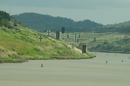
It seemed slightly inefficient to place so many markers together, especially since the turns of the channel made it difficult to distinguish which side the markers were on. Inefficiency seemed to be rule for the operation of the canal; many of the manual operations, such as passing the ropes leading the mule cables, were delayed by inattention to detail and unpreparedness. For example, at the Pedro Miguel locks, the rope that was passed was too tangled to actually reach the ship, and had to be pulled back and untangled.
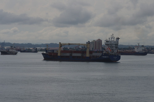
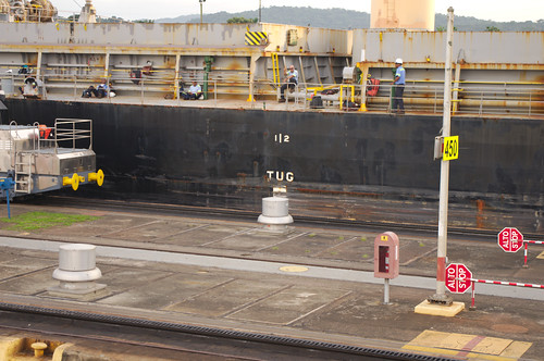
At the Pedro Miguel locks we also had the opportunity to see a Panamax class ship - the largest that the canal can currently handle - pass through the locks before us.
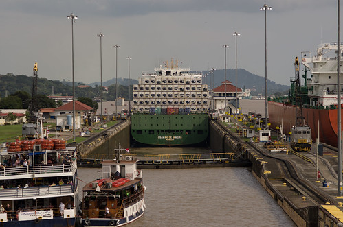
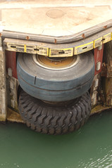
We were told that Panamax ships have less than six inches of tolerance on either side; we did not measure for ourselves, but having seen the CSAV Rio de Janeiro pass through before us, could easily believe it. As a result, there are many bumpers and fenders at points of potential collision. Some of these (e.g., on the left) have clearly been more successful than others (e.g., on the right), and many of the ships do not always make it through unscathed (e.g., below).
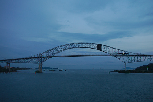
The Pedro Miguel locks lower ships down to the level of Lake Miraflores, a small artificial lake that leads only to the the Miraflores locks, the last two stages of the Canal heading towards the Pacific. After passing through the Miraflores locks and the Port of Balboa, we passed under the Bridge of the Americas out into the Pacific Ocean, and so ended our transit of the Canal just as the sun was setting.